Digital Solutions
GeoExplorer Software
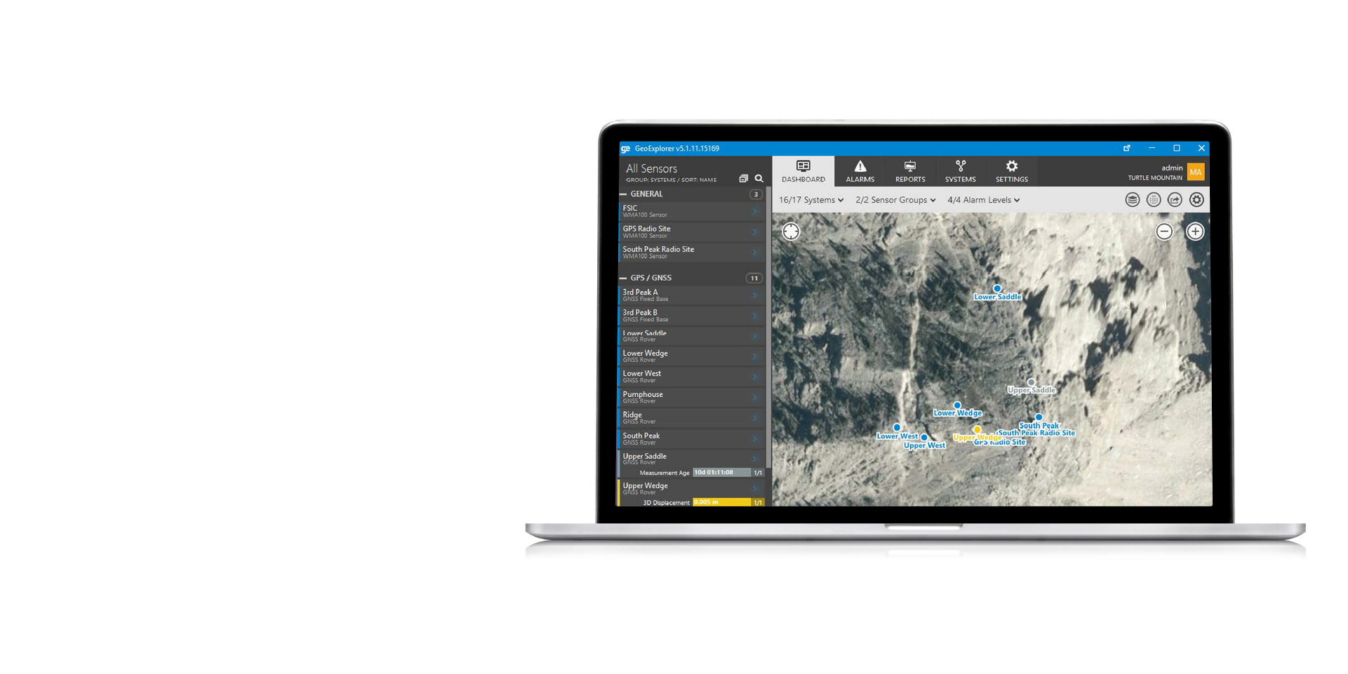
GeoExplorer by NavStar is the definitive all-in-one software solution crafted for comprehensive sensor data integration, management, visualization, and analysis.
GeoExplorer by NavStar is the definitive all-in-one software solution crafted for comprehensive sensor data integration, management, visualization, and analysis.
Designed to set the industry standard, GeoExplorer seamlessly handles data from diverse in-ground, IIoT, and geospatial monitoring systems, offering a unified, user-centric platform.
GeoExplorer transforms the way engineers manage and interpret measurement data by integrating a wide array of sensors and data types into a single streamlined system.
GeoExplorer’s unique ability to correlate diverse datasets, such as ground displacement with pore pressure, offers a holistic view of site conditions, optimizing resource utilization and project outcomes.
Benefits
Benefits
GeoExplorer provides many benefits to ensure safety and real-time deformation data telemetry.
Data insights
Ease of use
Improve safety
Product features
Product features
Total Stations & Prisms Module
Total Stations and prisms are powerful tools for monitoring a large number of points in a well defined area such as highwalls in a mine pit. GeoExplorer supports specialized monitoring total stations from top manufacturers such as Leica GeoSystems, Sokkia and Topcon. GeoExplorer has native support for these instruments and is capable of direct control of the instruments as well as all the associated data processing and adjustments.

GeoExplorer Overview
GeoExplorer Overview
Industries
Industries
Surface coal
Surface metal
Iron ore
Construction
Quarrying
Resources
Resources
NavStar range

Digital Solutions
Geospatial Devices and Interfaces

Digital Solutions
Service and Support
Speak with an expert
Speak with an expert
Whether you need support or simply want to learn more, reach out to our Geosolutions team. We’re here to help.