Civil Infrastructure
Dam and levee monitoring
Risk mitigation through real-time deformation monitoring.
Dam and levee monitoring
Dam and levee monitoring
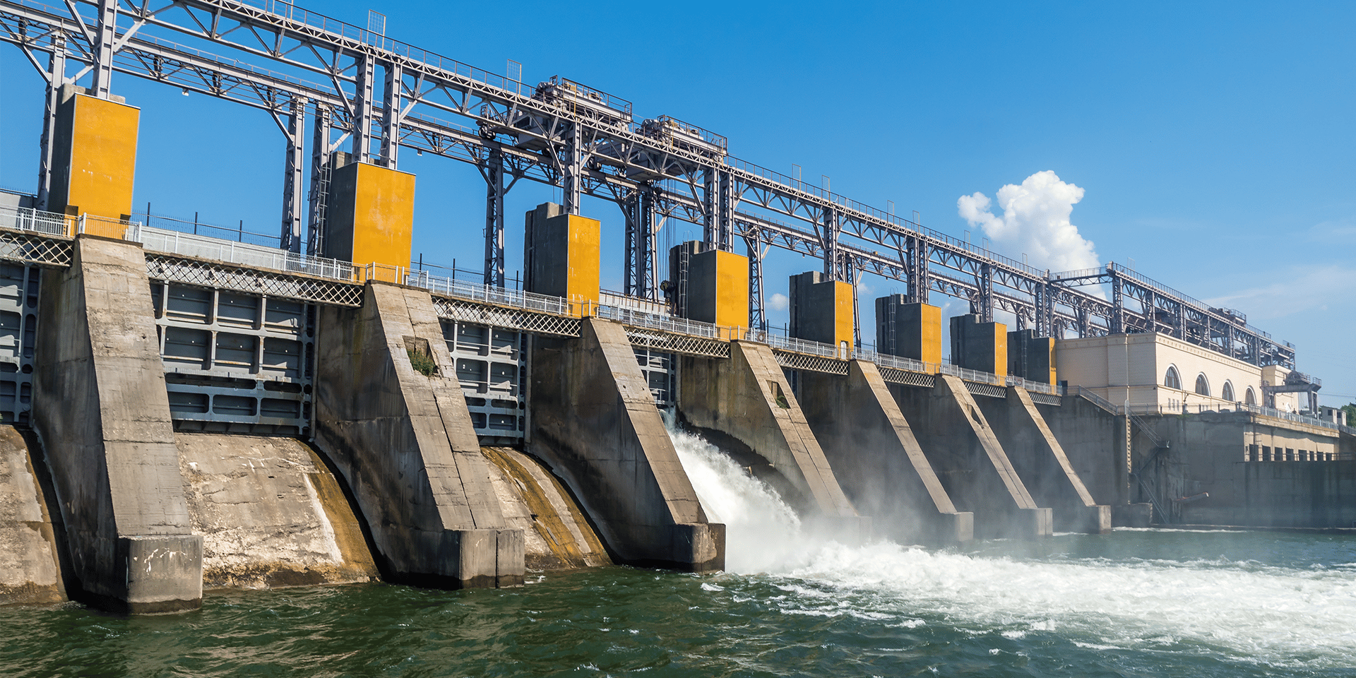
A dam is built to endure, but time, weather, and pressure never stop testing it. Every season brings new conditions: rising water, shifting foundations, small changes that build up over years. When those changes go unseen, risk grows quietly. That is why constant, dependable dam monitoring is not optional, it is the backbone of safe, responsible operations.
Orica Digital Solutions’ Geosolutions, products RST Instruments, and Measurand, helps operators keep that watch. Our systems measure pore pressure, seepage, stress, and deformation, turning raw data into clear warnings before an issue becomes a threat. Whether you manage a hydroelectric asset or an irrigation dam feeding local farms, the goal stays simple: maintain stability, protect communities, and keep water moving safely
Why dam structure monitoring matters
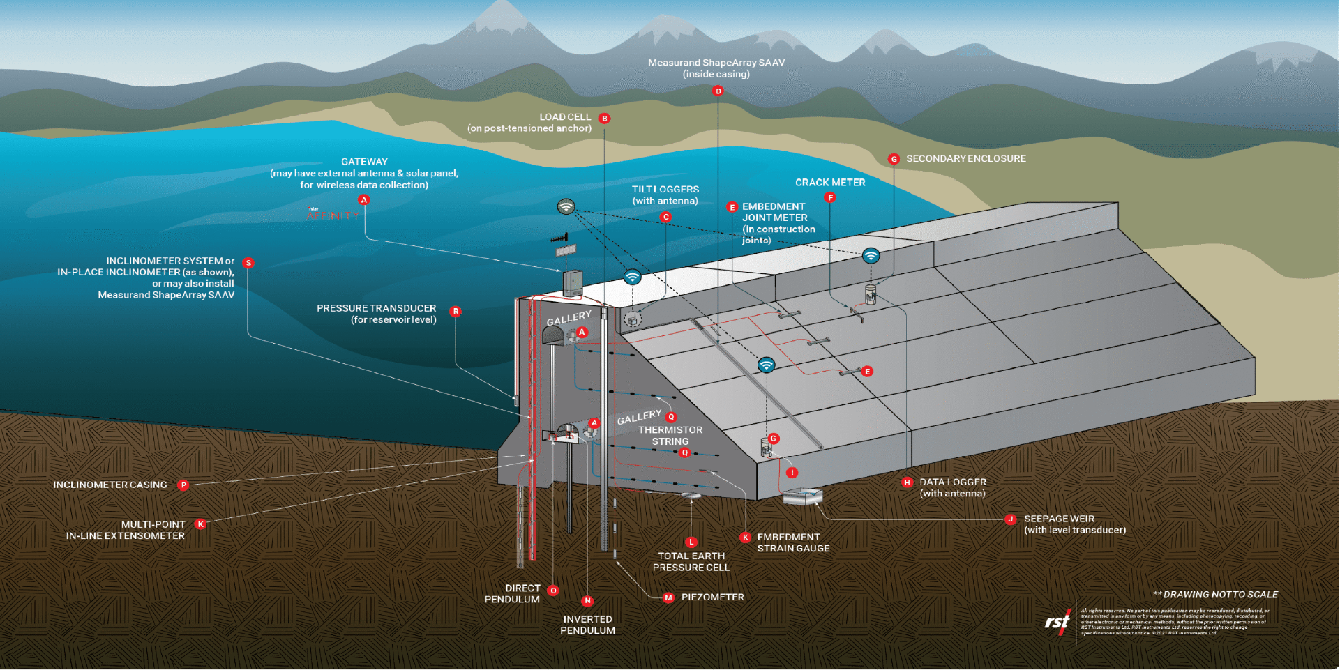
No two dams behave alike. Each one tells a story shaped by design, foundation, age, and climate. A week of heavy rain, a tremor upstream, or a shift in load can all trigger subtle movement. Most of it happens out of sight, deep inside the structure. Without the right tools, those early warning signs are easy to miss.
That is where dam structure monitoring steps in. Modern systems watch every layer, from crest to foundation and out into the reservoir. Seismic motion instrumentation adds another dimension, recording vibration and stress so engineers can see how the dam reacts to both natural and operational forces.
Over time, those readings paint a picture. Patterns emerge. When the data begins to change, plans change too. That is what keeps downstream communities safe and the structure performing the way it was meant to.
Benefits
Benefits
Driven by innovation and backed by our global R&D and technical networks, we deliver solutions that solve real operational challenges.
Improve safety
Data insights
Solution powered by

Digital Solutions
RST Instruments

Digital Solutions
Measurand
Working with Orica Digital Solutions' Geosolutions
Working with Orica Digital Solutions' Geosolutions
When you work with Orica Digital Solutions’ Geosolutions, you get more than instruments, you get people who have been around dams, levees, and the challenges they bring. Supported by RST Instruments, Measurand, and 3vGeomatics, our teams bring together solid engineering knowledge and technology that has been proven on sites around the world.
This partnership does not stop when the system’s installed. It is a continuous process, refining, improving, adapting, so operators can manage risk with confidence, not guesswork.
Turning monitoring data into practical decisions
Good data helps you make the right call at the right time. Geosolutions brings together radar, sensors, and satellite insights to give a real-time view of dam behaviour. The system shows what is stable, what is shifting, and what needs attention, without drowning engineers in unnecessary detail.
We do not hand over the technology and walk away. As the structure ages and conditions evolve, we stay involved, checking that the system is still telling the truth on the ground. That ongoing relationship means fewer surprises, faster responses, and stronger compliance across the board.
If your focus is on long-term safety and reliability, talk to Orica Digital Solutions’ Geosolutions. We will help you build a dam monitoring approach that is robust, adaptable, and ready for the next challenge nature delivers.
Dam and levee monitoring FAQs
What is dam and levee monitoring?
It is the continuous measurement of movement, pressure, and deformation within dam structures and surrounding ground to ensure ongoing stability and safety.
How does dam structure monitoring work?
Sensors track water pressure, displacement, and vibration in real time. The data is analysed through monitoring systems to detect changes before they become critical.
Why is dam monitoring important?
It helps operators spot early warning signs, protect downstream communities, and maintain the long-term integrity of vital infrastructure.
What are the key components of a dam monitoring system?
Piezometers, tiltmeters, and deformation sensors connect to data loggers and software platforms, giving engineers a clear picture of structural behaviour above and below ground.
Case Studies
Orica's industries

Industry
Agriculture

Industry
Civil infrastructure

Industry
Construction

Industry
Energy

Industry
Iron ore

Industry
Oil and gas

Industry
Quarrying

Industry
Surface coal

Industry
Surface metal

Industry
Underground construction and tunnelling

Industry
Underground mining
Want to know more about our solutions?
Want to know more about our solutions?
Contact an expert by completing the form.