Digital Solutions
Historical Analysis
Radar satellites have been collecting images around the globe since the early 1990’s. Urban and rural locations worldwide have archive data available for InSAR analyses.
One-time Historical InSAR Analysis
One-time Historical InSAR Analysis
3vG can conduct a data archive search of all of the relevant satellite image databases to determine data availability over your specific area of interest.
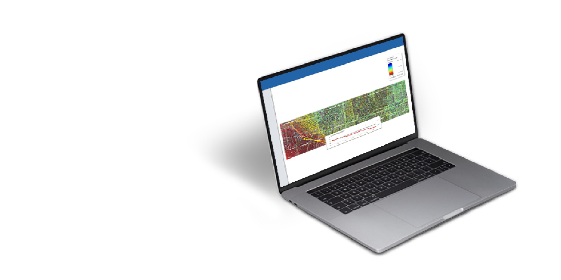
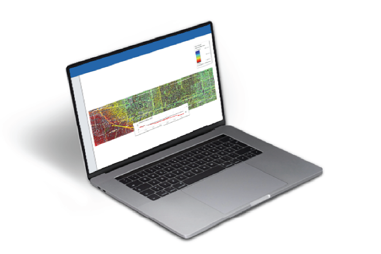
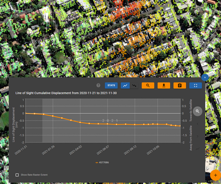
If sufficient imagery is available, we can conduct an InSAR analysis of these images to measure displacement over the associated time frame. An example of the type of InSAR results generated from historical archive images for a portion of a major U.S. city is shown in the figure to the right.
Benefits
Benefits
Historical Analysis provides many benefits to ensure safety and real-time deformation data telemetry.
Data insights
Ease of use
Field to cloud data workflows
Improve safety
Features
Features
Understand historical slope movement or infrastructure displacement.
Industries
Industries
Underground mining
Quarrying
Underground construction and tunnelling
Construction
Civil infrastructure

Digital Solutions
Displacement DataStream

Digital Solutions
Motionary
Case studies
Speak with an expert
Speak with an expert
Whether you need support or simply want to learn more, reach out to our Geosolutions team. We’re here to help