
Digital Solutions
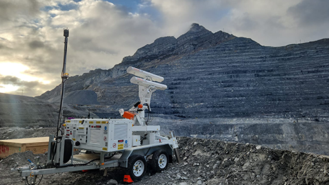
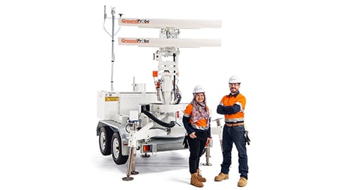
GroundProbe SSR-FX
Broad area slope stability radar.
Strategic, broad area solution
Strategic, broad area solution
The SSR-FX is a monitoring system designed to provide geotechnical peace of mind. An expert tool for risk and hazard identification, the SSR-FX is a 2D Real Aperture Radar (RAR) specialising in detecting movement across vast mine sites over a long period of time, even in non-critical areas.
Industries
Industries
Surface coal
Surface metal
Iron ore
Quarrying
Construction
Product features
Product features
High resolution performance
With a pixel resolution of over 1.4 million per scan, updated every two minutes, the SSR-FX allows its users to identify new risks and hazards to make quick and accurate in-pit decisions.
The SSR-FX is a Real Aperture Radar that generates fine azimuth angles and small range pixels, delivering real aperture radar measurements you can trust.
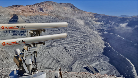
Enhanced plan view
GroundProbe SSR-FX uses an intuitive, patented Plan View visualisation method that represents radar data and multiple layers of mapping data from above. At the centre of the visualisation is an eye-line that links the plan view with high-resolution photographs taken by the radar. The two projections are linked, tracking together, enabling its users to view an entire pit at a glance to instantly detect and locate any hazards.
Constant sub-millimetre deformation measurement accuracy
A key benefit of interferometric-based radar technology, the SSR-FX doesn’t lose measurement accuracy as range increases. Deploy the radar 30m or 3,500m from the area of interest, and its sub-millimetre deformation measurement accuracy remains.
Case studies
GroundProbe® SSR-FX / Slope Stability Radars / Digital Solutions
GroundProbe® SSR-FX / Slope Stability Radars / Digital Solutions
Related products

Digital Solutions
GroundProbe SSR-XT Slope Stability Radar

Digital Solutions
GroundProbe SSR-FX Slope Stability Radar

Digital Solutions
GroundProbe SSR-SARx Slope Stability Radar

Digital Solutions
GroundProbe SSR-Omni
GroundProbe range

Digital Solutions
GroundProbe Software

Digital Solutions
Reactive Radars

Digital Solutions
Service and Partners

Digital Solutions
Services

Digital Solutions
Geotechnical Specialist Services
Explore more
Orica Digital Solutions’ Geosolutions, a global leader in geotechnical, geospatial and structural monitoring. We deliver a complete portfolio, from sensors to services, for mining and civil infrastructure customers. Our expertise is grounded in Orica's innovation and technical excellence that span more than 150 years.
Contact an expert
Contact an expert
Whether you need support or simply want to learn more, reach out to our Geosolutions team. We’re here to help.