Digital Solutions
GroundProbe SSR-Omni
Full coverage, high resolution.
Full-coverage monitoring.
Full-coverage monitoring.
Industries
Industries
Iron ore
Surface metal
Surface coal
Construction
Quarrying
Product features
Product features
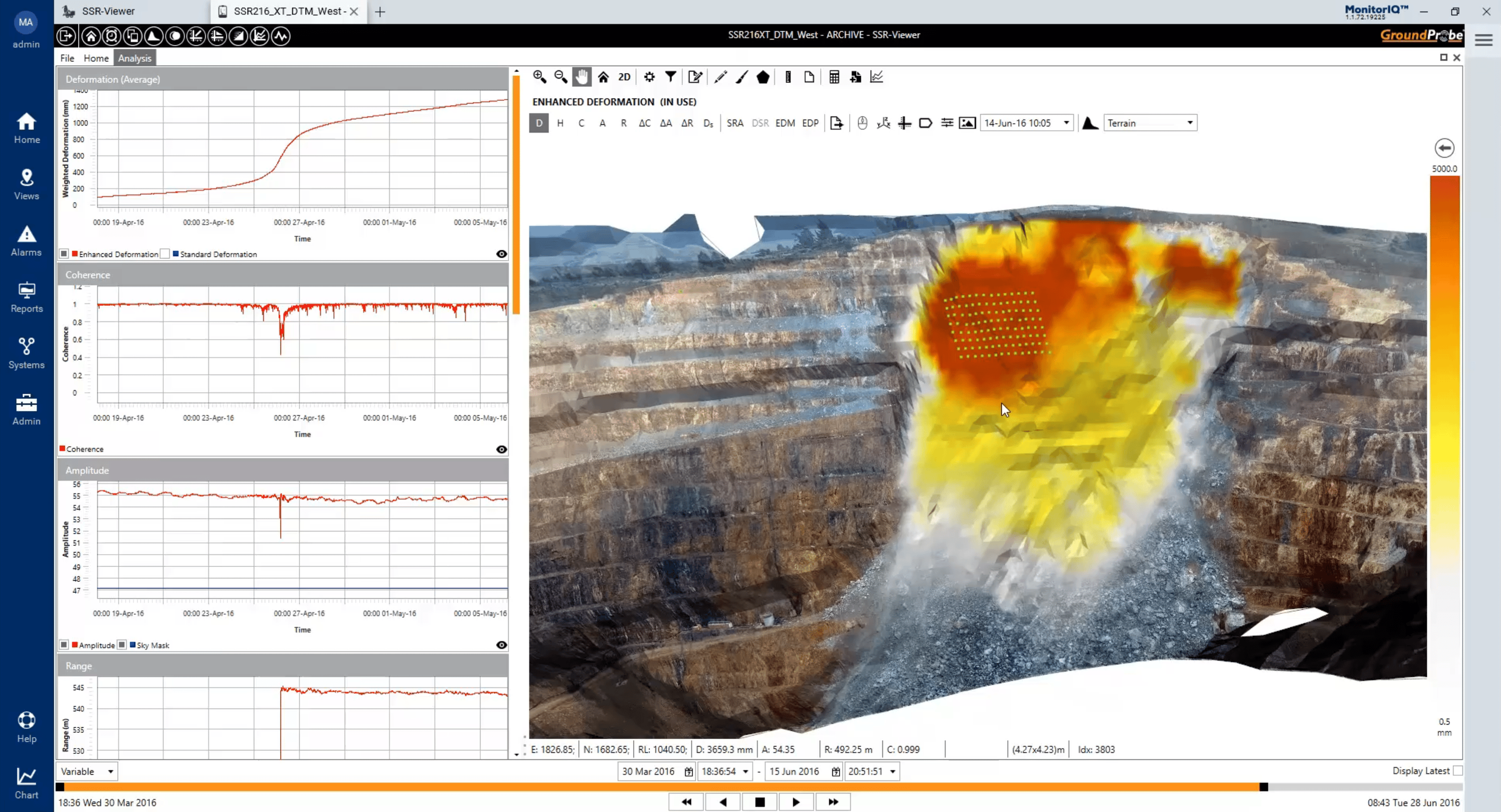
Highest resolution with the sharpest definition
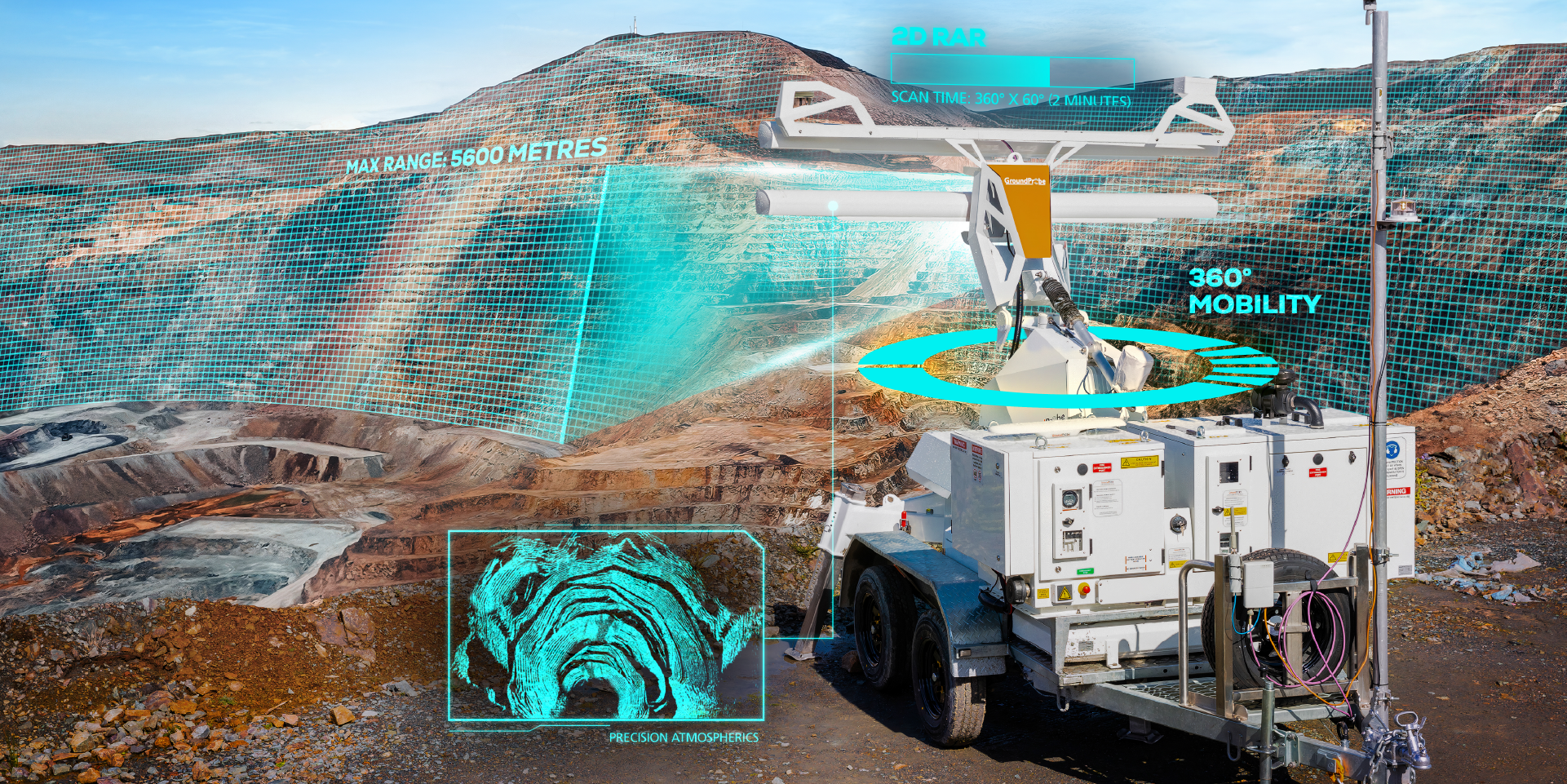
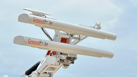
With its fine spatial footprint defined by its 2.74m aperture baseline, the SSR-Omni is the highest-resolution rotational radar in the market. It is also equipped with the sharpest definition modes, selectable between 0.08, 0.24 and 0.33-degree pixels, each at 0.1-millimetre accuracy. Its small pixel size allows users to confidently locate and distinguish true areas of movement with the ability to see smaller movements earlier.
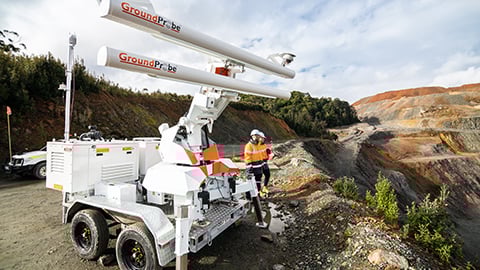
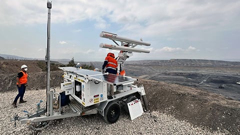
All-encompassing 360° scans
The system provides full coverage, 360° monitoring. Completing a 360° acquisition every 40 seconds, all new risks and deformation hot-spots are detected quickly so that users can act on them fast.
Ultra-precise positioning, in-built tilt sensing and augo georeferencing
The SSR-Omni is equipped with an all-in-one GNSS, giving its users information about their radar’s location, alignment, and tilt with great precision. With built-in geospatial positioning technology, the radar’s location is also automatically georeferenced in MonitorIQ® Desktop.
MonitorIQ® Desktop is our dedicated geotechnical analysis platform and the standard platform across all our systems and sensors.
For over 20 years, our industry-proven MonitorIQ® Desktop software has provided rapid, precise data analysis to detect trends, with the ability to send alerts for immediate action.
GroundProbe® SSR-Omni / Slope Stability Radars / Digital Solutions
GroundProbe® SSR-Omni / Slope Stability Radars / Digital Solutions
Case studies
Related products

Digital Solutions
GroundProbe SSR-XT Slope Stability Radar

Digital Solutions
GroundProbe SSR-FX Slope Stability Radar

Digital Solutions
GroundProbe SSR-SARx Slope Stability Radar

Digital Solutions
Geotechnical Specialist Services
GroundProbe range

Digital Solutions
GroundProbe Software

Digital Solutions
Reactive Radars

Digital Solutions
Service and Partners

Digital Solutions
Services

Digital Solutions
Slope Stability Radars
Explore more
Orica Digital Solutions’ Geosolutions, a global leader in geotechnical, geospatial and structural monitoring. We deliver a complete portfolio, from sensors to services, for mining and civil infrastructure customers. Our expertise is grounded in Orica's innovation and technical excellence that span more than 150 years.
Contact an expert
Contact an expert
Whether you need support or simply want to learn more, reach out to our Geosolutions team. We’re here to help.